There are more than a hundred different types of clouds. Luckily, they aren’t hard to learn because they are categorized in a very logical order. Once you learn a few basic definitions, you’ll be identifying every cloud in the sky with no problems.
Clouds are classified based on their physical characteristics, and further on where they lie in the atmosphere. Meteorologists use Latin terms to describe clouds and their features. Here’s a look at ten of those terms and their meanings.
Cloud Types by Characteristics
There are various types of cloud formations. These are generally representatives of how the cloud looks, or by other apparent characteristics. There are many more Latin words used to describe cloud formations with great specificity; these are just a few of the most common. If you’d like to learn even more cloud names, check out What’s This Cloud.
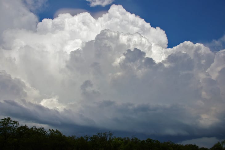
1. Cumulus Clouds
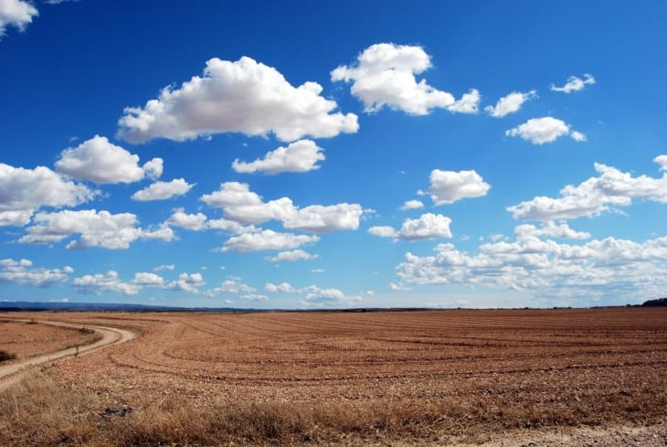
One of the most common cloud terms you’ll hear in aviation, cumulus clouds are puffy white clouds. On a nice summer day, you may see small, pretty white clouds that look like cotton balls. Those are classic cumulus clouds.
The atmosphere must provide some lift to make a cumulus cloud. This gives the clouds that puffy look, which grows upwards as the air currents rise. If the atmosphere is unstable and the cloud gets very tall, these clouds can get many thousands of feet tall.
The atmospheric lift, or convection, that makes cumulus clouds rise also means turbulence for pilots. While flying through a layer of summertime puffy cumulus may result in only a few minor bumps along the way, the turbulence inside a very tall towering cumulus can be severe.
2. Stratus Clouds
Stratus clouds are the opposite of cumulus clouds; instead of being puffy, they are stratified or layered. Imagine a grey, rainy English day with a solid overcast layer of grey clouds. These are classic stratus clouds.
Unlike cumulus clouds, stratus clouds indicate that the atmosphere is stable and that there is very little lifting force or convection present. Pilots expect the ride to be nice and smooth inside stratus cloud layers.
In some cases, stratus clouds are thick and grey, completely blocking out the sun. But sometimes, when they are at high levels in the atmosphere like cirrostratus clouds are, they may be translucent and allow you to see the sun through them. These types of clouds are usually responsible for sun haloes and sundogs.
3. Stratocumulus Clouds
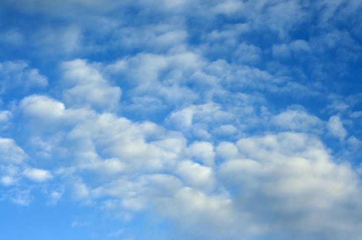
It is possible to combine both of these types of clouds into one. A stratocumulus cloud is one that covers a large area but is made up of puffy clouds. They are thick and conjoined, but you can probably see bits of sky through some gaps.
Stratocumulus clouds often allow rays of sunlight to shine through. According to the University of Massachusetts Cloud Atlas, this is sometimes called “Jesus’ rays,” but the proper name for the phenomenon is crepuscular rays.
Also read: Why Planes Fly in The Stratosphere?
4. Nimbus Clouds
If a cloud is raining, it is described as “nimbo-“ or “-nimbus.” For example, a cumulus cloud with rain is known as a cumulonimbus. This is the proper name for the type of cloud that makes a thunderstorm.
And that flat cloud from the rainy English day? That’s a nimbostratus cloud.
5. Lenticular Clouds

Lenticular, or lens-shaped, clouds form under a very particular set of circumstances that are of interest to pilots. The standing lenticular cloud is a stationary cloud that forms on top of mountains. When strong winds hit the mountain, they are forced upward by the terrain. The air cools and creates a cloud that caps the ridge.
Beautiful lenticular clouds look very peaceful, but to pilots, they indicate strong wind and turbulence. Pilots know to avoid flying in these areas.

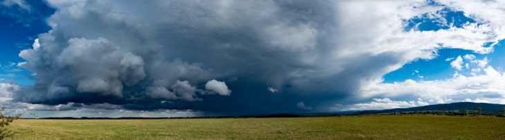
6. Mammatus Clouds
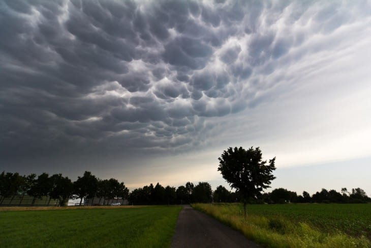
Cumulonimbus clouds, or thunderstorms, are places of violent upheaval in the atmosphere. Vertical wind shear can be thousands of feet per minute–something all pilots want to avoid. Thunderstorms spawn tornadoes, microbursts, hail, and lightning.
Cumulonimbus mammatus clouds are an indication of a severe thunderstorm capable of hazards like these. “Mammatus” describes the wavy, pouchy look on the bottom of the cloud. These clouds are dark and foreboding, and their uneven underside is a visual indication of the turbulence in the atmosphere.
Groups of Clouds

In addition to how a cloud looks, clouds are groups by how high they are in the atmosphere. These groups are sometimes called the “Families of Clouds.” Cloud groupings and basic weather theory is covered in the FAA’s Pilot’s Handbook of Aeronautical Knowledge, Chapter 12.
7. Cirrus (High Clouds)

Clouds located high in the atmosphere are commonly called cirrus clouds. They are made of ice crystals and often have a wispy look to them. If they fit another description, they will be described with the prefix “cirro-,” for example, cirrocumulus. These clouds look like fish scales, and sailors call them “mackerel scales.”
Cirrus clouds are a type of cloud unto themselves. They have a specific look due to the ice crystals spreading in the upper-level winds. They are commonly called “mares’ tails.”
High clouds can provide clues about what is going on in the upper atmosphere. For generations, sailors have used these clouds to get an idea of the weather that is coming. An old proverb says, “Mares’ tails and mackerel scales make lofty ships carry low sails.” That means that when both clouds are seen together, storms are on the way.
Technically, jet contrails are a type of cirrus cloud. But they are generally not considered clouds since they are human-made.
8. Alto (Middle Clouds)
In the middle levels of the atmosphere, you will find the “alto-“ clouds. These clouds lay between 6,500 and 20,000 feet above the ground.
9. Low Clouds
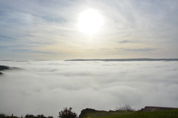
Clouds near the earth’s surface are commonly referred to by only their characteristic features, like cumulus, stratus, or stratocumulus. There’s no word precisely for “low cloud,” but if the cloud touches the ground, it is fog.
10. Clouds with Extensive Vertical Development
Many clouds grow and build as the air rises in an unstable atmosphere. These clouds span the other three categories, beginning near the surface and growing up until they are surrounded by high clouds.

This family of clouds will always be made up of cumulus clouds since these are the types of cloud that grows upward. The two main clouds with vertical development are towering cumulus clouds and cumulonimbus clouds.
Related Posts
- Santiago Flight 513: The Mystery of the Vanishing Aircraft
- What is a Flight Purser: Everything You Need to Know
- Kerosene vs Avgas: What's The Difference?
About the Author